Wednesday, September 4, 2013

Nova Scotia - Cape Breton Island

The last few days on PEI were an opportunity to wrap a few things up and prepare for our move to Nova Scotia. The interior of the RV was cleaned and some needed stocking up on groceries and fueling the truck. A couple more short trips to revisit a few places which included buying some bread from John Dale, the baker at the Cardigan Farmer’s Market, and donate a few books to the Cardigan Library. Over to Georgetown and the Maroon Pig for some more bakery. Back to Montague and lunch at The Station Cafe. Then finally back to the Rv for happy hour and a last glimpse of the horses.

John Dale, the baker and lunch at The Station Cafe in Montague
We had spent a month on PEI eating mussels and seeing the waters where mussels were harvested. And most everyday while we were in a harbor where fishing boats were coming and going, we observed mussels being harvested. But did we really know anything about mussels? Not really. So we asked the locals.
Their answers were very helpful. But rather than rewrite what someone else has so nicely summed up, go to this writeup. Be sure to click on Chef Michael Smith's embedded video for a visual summation. Interested in cooking mussels? Pretty easy for our friends in the Fox Cities. Niemuth’s Southside Market gets fresh PEI mussels (check for availability). They’re dead easy to prepare.

crossing to Nova Scotia
August 29, Thursday, proved to be cloudy and overcast. We arrived at the Northumberland Ferries Limited Wood Islands ferry terminal in plenty of time to use some free wifi and sip coffee. A little after 9:30 a.m., the ferry was ready to board. We snugged into the lower deck among “the big guys”, several semis. All the cars were boarded on the upper deck. Have to say that seeing the large red “NFL” letters emblazoned on the ferry, we couldn’t help but think of football...especially this time of the year.
We made our way up to the lounge area where people were in a long cue to order food. Carol got herself a second cup of coffee and we went topside where we managed to spend most of the 90-minute crossing, looking for anything that moved on or in the water. Not much doing on the strait so we spent the bulk of the trip chatting with a lone biker from Alberta, who like us, had never been to Nova Scotia. There was a Harley rally in Digby which is where he was headed.
Once the ferry docked in Caribou, Nova Scotia (where we added one more “lifer” Canadian Province) we stopped at a visitor center to pickup more local information, then onto the Trans Canada Highway headed for Baddeck (beh-DECK), 136 miles away. We entered Cape Breton Island when we crossed the Canso Causeway across the Canso Canal. Since the causeway, which opened in 1955 to accommodate vehicular and rail traffic to and from the island, completely blocked the Strait of Canso, it also had a massive lift bridge to allow shipping to pass.

site 257 at Baddeck Cabot Trail Campground, Baddeck, NS
Now traveling up the 105 (Mabel and Alexander Bell Highway) the scenery definitely started to change. A lot more steep hills and valleys compared to eastern PEI. Tummies were rumbling by now so we stopped at The Farmer’s Daughter in Whycocomagh. Interesting to note that roadsigns were no longer in English and French but English and Gaelic.
Late afternoon we finally pulled into the Baddeck Cabot Trail Campground, checked in, found our site, and settled back for a bit to plan our next five days. We would not have nearly as long in Nova Scotia and wouldn’t have the luxury of time that we had on PEI.
The Cabot Trail on Cape Breton Island was the main draw. Known its scenic beauty, the trail skirts the upper two thirds of Cape Breton, weaving through an Acadian Region plus many Irish and Scottish settlements. The top of the island is where the Cape Breton Highlands National Park of Canada is located. Choosing this campground put us in a position to enter the Cabot Trail from either direction. One direction ran clockwise north along the Gulf of St. Lawrence, while the other ran counterclockwise along the Atlantic Ocean. Both routes would pass through the national park so it didn’t really make much difference which way we would travel. Either way, when we ended, we would be close to home. About the only consideration that might dictate which way we started was our preference of where the sun would be at a particular time of day.
Finding the sun turned out to be the tricky bit. On Friday, our first full day, it was overcast with spits of rain. The weather forecast looked pretty bleak for the next week but the best chance of sun would be Saturday. So today we opted to stay close to home and see what Baddeck had to offer. Quite a bit, it turned out.

at the A.G. Bell historic site; the Silver Dart and the HD-4 hydrofoil
Baddeck was the summer residence of Alexander Graham Bell which explained why the Alexander Graham Bell National Historic Site was located in Baddeck. What better way to spend a yucky weather day than learning about A.G.B.?
The museum (a modest admission fee required) overlooking the Bras d’Or Lakes, featured many personal artifacts donated by the Bell family. A self-guided tour of the museum explained in great detail Bell’s early childhood and his passion for working with the deaf and how that work led to the invention of the telephone, which most people associate with Bell’s legacy. However, the museum also had on display the HD-4 hydrofoil watercraft and a full-scale (working) reconstruction of the Silver Dart aircraft. Huh? Aeronautics and marine engineering?
Oceanographer Robert Ballard, like Bell, has made countless major discoveries in the world of science. His work work with deep sea vents is what Ballard feels is his most important contribution. Yet to his displeasure, he’s probably most remembered for finding the Titanic. Like Ballard, Bell was most remembered for his invention of the telephone, but in retrospect, Bell considered his most famous invention an intrusion on his real work as a scientist and refused to have a telephone in his study.
Bell's collaboration with four young men (Casey Baldwin, Douglas McCurdy, Lieutenant Thomas Selfridge and Glenn Curtiss) resulted in the Aerial Experiment Association, founded in 1907. The "Silver Dart", the Aerial Experiment Association's fourth flying machine, was flown off the ice of Baddeck Bay, a sub-basin of Bras d'Or Lake, on 23 February 1909, making it the first controlled powered flight in Canada.
In later years, Bell and Baldwin turned to experiments with hydrofoil watercraft that culminated in the development of the HD-4. Designed and built at Bell's Beinn Bhreagh laboratory near Baddeck, the HD-4 set a world marine speed record of 70.86 miles per hour (114.04 km/h) on the Bras d'Or Lakes at Baddeck, that stood for two decades.

Initially Bell’s work took place at his Beinn Breagh (Gaelic for “beautiful mountain”) estate in the summers but later became full-time. He chose Beddack because the surroundings were reminiscent of his birthplace in Edinburgh, Scotland. Now in private hands and not open to the public, the estate owners still honor the preservation of the property.
Following the AGB tour we drove down the road to the campus of the Gaelic College, a school devoted to the study and preservation of the Gaelic language and Celtic arts and culture.

 A summer session had just wound down and the grand hall was being prepped for a wedding so we skipped a tour and confined ourselves to the extensive gift shop. I passed on an invite to pose for a photo in a kilt (it would have clashed with my t-shirt...or the other way 'round I think) and, also passed on the option of being measured for a custom handmade kilt of the Graham tartan (use this finder to locate Graham tartans). Cool, but major dollars...and I'd have to wear it all the time to justify the cost. A Scottish wool tweed county cap struck Carol as being "my style", although the price was a wee bit high.

Harris Tweed
Back in Baddeck we did a walkabout exploring various shops before settling in for a light lunch at "Three Doors Down". More seafood chowder of course. One of the better chowders we've had. When we saw the local fire department and library sharing the same building, we wondered about what the job description might be like at the Beddack Fire Department/Library:

"Help! My house is on fire!"
"We'd be glad to help but you'll first have to take care of that long overdue book fine."
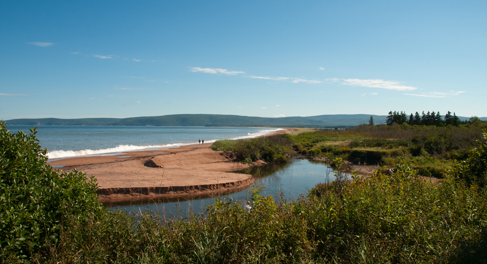
South Bay Ingonish
By late afternoon the winds had picked up dramatically. The rains came, and along with high winds, continued all night. Our prospect for a decent day on the Cabot Trail appeared to be in jeopardy in spite of the forecast which had mentioned sunny weather.
The RV park manager had marked several interesting “to do” stops on the Cape Breton Island map. Since most of these were on the east side it looked like a counterclockwise route would be best. By 8:00 a.m. on Saturday morning, we were out the door and on the road.
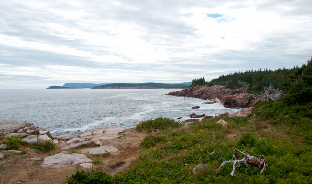
Overcast but not raining. In the distance there almost appeared to be a glimmer of blue. But for the time being it remained overcast and gray when we stopped at Cape Smokey, a picnic area and trail head. The most impressive part (more impressive on a sunny day we figured) was the view back down the coast facing south. And with nearly 5,000 miles of coastline in Nova Scotia, there’s a lot to look at.
Due to the extensive coastline, the surrounding Atlantic ocean has a moderating effect making Nova Scotia the warmest of the Canadian Provinces. Probably still not warm enough for us in the winter we guessed.

hiking Middle Head and birding at the tip
Winding around Ingonish Harbour we entered the Cape Breton Highlands National Park where we would spend the bulk of our day. The park operates the Keltic Lodge, one of the “must see” points. While the lodge was lovely, it was the trail on Middle Head, a narrow peninsula separating two ocean bays, the North and South Ingonish Bays, which was where we were headed. Still overcast but there was some promise of the sky brightening up as we started hiking the 2.4 mile trail. Nice look-offs from cliff faces onto both bays. By the time we had returned to the truck, it was almost all sun overhead.

Kelty Lodge
The road north hugged the coastline with opportunities for overlooks at Broad Cove, Green Cove, MacKinnen Cove, Black Brook Cove and finally Neil’s Harbor where we had heard that lunch at The Chowder House was not to be missed. After our hike on Middle Head we figured we had earned it. The crab seafood corn chowder is definitely one you'll want. Or any of their chowders for that matter.


Black Brook Cove
White Point
Looking across Aspy Bay toward North Mountain
An alternate scenic route took us out of the park boundary inland until we hit the coast again near White Point where the view northwest across Aspy Bay to North Mountain was spectacular. At Cape North we took the option to head along North Mountain to where the road eventually ended at Capstick. A several kilometer long hiking trail from Capstick lead to Meat Cove. However, since we had already dawdled away more than half the day and were not even halfway through the driving tour, we didn’t go that far knowing we would also have to double back. But we did drive as far as the beach at Sugarloaf where Cabot Landing Provincial Park day use park is located. Here is where Italian Giovanni Cabato (John Cabot) is purported to have made landfall in 1497. The governments of Canada and England say otherwise. They recognize Cape Bonivista, St. John’s, Newfoundland, for this honor. Historically speaking no one really knows for sure. Regardless, Cabot was the first European to encounter the mainland of North America since the Norse Vikings and the Cabot Trail is named after the man.

Sugarloaf at Cabot Landing P. P.
The Lone Sheiling and stream running through
We retraced our route back to North Cape then headed further west back into the park, crossing over North Mountain. Coming over the mountain we came to a pull-off where The Lone Sheiling, a Scottish crofter’s hut is nestled in an old-growth forest where a 350-year old sugar maple resides. Another pull-off described the Aspy Fault, a fault probably dating back to the Ordovician period when two continental plates collided and pushed the seafloor upward.

MacKenzie Mountain look-off
Near Pleasant Bay we hugged the coastline of the Gulf of St. Lawrence before cutting back inland and up and over MacKenzie and French Mountains, at one point reaching over 1500 feet. Hardly Colorado Rocky Mountain altitudes but compared to PEI, we were flying high. At one MacKenzie Mountain look-off we found a collection of several panels describing the sea life food chain complete with depictions of various whales we might see. From our high vantage point Carol found some bumps surfacing on the waters near a boat. Through our scope we determined the boat to be a whale watching trip and it had in fact found some whales - Pilot Whales. We shared scope views with others who happened to stop including a British couple on holiday who were also staying in the Baddeck area. Another MacKenzie Mountain look-off a bit further on had several more descriptive panels describing the Gulf's currents, fish species, and how the currents affect Atlantic Canada weather.

French Mountain Bog
Even though the truck’s clock now indicated that we might not make it home until after dark, we couldn't pass up the self-guided boardwalk trail near French Lake on top of French Mountain. French Mountain Bog was 1350 feet above sea level. Not so much a bog as a highland plateau sloped fen. A low boardwalk allowed us to glide through the last throes of this year’s Pitcher Plants, and Sundew plants. Horned Bladderwort had gone to ground. Vestiges of Bog Rosemary were found if one looked low enough. Clearly, there were a few places were moose had lain.

nice finish to a long day
By the time we reached Cheticamp it was well after 6:00 p.m., still an hour from home. The day had been long. With the much hoped for sun now staring us in the face, we sped for home. As it turned out this would be the ONLY day in Nova Scotia that was sunny!
When we arrived back at the park we were astounded to find a bazillion children running rampant. The park was brimming with RV’s that were not there when we left. From a sleepy little park to a small town - all in one day! Campfires blazed, the sky was filled with smoke as children with pent up energy raced and played. It was Labor Day Weekend and folks were taking advantage. But come Sunday and more rain, everyone was hunkered down as the rain pretty much continued on and off all day. One side benefit: all the kids were RV bound. Well, at least it was a benefit for us. Not so much for all their parents and grandparents.
On Monday we still couldn’t catch a break with the weather. But a second day of just sitting wouldn’t do, so what better time than to tour the Big Spruce Brewery and the Glenora Distillery and Inn? 

The Big Spruce; Carol with owner Jeremy White
Once we found the Big Spruce Brewery just west of Baddeck (no signs on the main road yet that we could see but we had directions from a local), we pulled up a gravel drive (marked by a very nice sign) to find a fellow painting the front of the building and an English Bulldog named "Church" sitting next to a post on a deck filled with beer kegs. The deck sign had the word “beer” in scrawled letters with an arrow pointing toward the building. This must be the place. And a larger "COLD BEER" sign was another giveaway.
We walked up onto the deck to a door that said “open” but it was locked. Oh no! But someone inside came to let us in. It was the owner Jeremy White. “Yes, we’re closed but c’mon in!” Didn’t have to say it twice.
It turned out that Jeremy had lived in Costa Rica for a time and knew Richard Garregues. Small world. The business had only just been started five months earlier so things were still getting organized. In fact there are only a handful of craft breweries in Nova Scotia and this was the first for Cape Breton. Certified organic Jeremy didn’t have anything good to say about GMOs.
We had wanted some Cereal Killer Stout but they were out. But Jeremy did have a small sample to try. Nice. Moderately dry stout with deep chocolate, licorice and coffee taste. Said he would have some in a day or two so to come back. In the meantime we settled on a growler of the Kitchen Party Ale, bitter, dry hopped, full bodied ale, with hints of citrus and pine. They sell kegs to local restaurants for their taps but over the counter at the brewery, it only comes in a growler.

Glenora Inn and Distillery; where the mash starts
If Big Spruce was the only craft beer on Cape Breton Island, then we had to next visit the only place in North America that produces a single malt whiskey, the Glenora Inn and Distillery near Mabou. Establed in 1990, it wasn't until 2000 when the first bottling of Glen Breton Rare occurred. Today the distillery sells a 10, 15 and 17 year-old single malt. A the end of a half hour tour, a one ounce sample of the 10-year was offered. Yum. But it’s still priced pretty high priced. The sample would have to do.

the stills (brought from Scotland) and the finished products
Getting on close to lunch and given that we were close to Mabou, we wanted to try the Red Shoe Pub for lunch. Recommended by our RV camp manager, we were not disappointed with the chowder or the haddock. Finally - some homemade tarter sauce! Then we made our way down to the Mabou Harbour before pushing on.

fishing boats in Mabou Harbour
We’d read that in Port Hood there was a long, lovely boardwalk that lead to the beach. Well, neither Port Hood nor the beach were hard to find...just the boardwalk. That’s because the first beach we came to was their "Municipal Beach." Where we needed to be was at the "Boardwalk Trail" beach. It took a bit of searching to find but was well worth the effort.

Boardwalk Park
The long boardwalk cut through dunes and marsh before breaking out to the beach. One could walk the boardwalk back to the parking area or complete the circle back to the parking lot along the beach. As it was low tide, the beach route was more appealing. Apparently appealing to the endangered Piping Plover, too. A pair had successfully reared young there this year (although they had departed by the time we had arrived). But what should have been a fairly quick beach walk turned into a major distraction when we discovered sea glass. By the time we had finished scouring the beach a few times, Carol had quite a pocketful of sought after sea glass.

Melody and Dick Cameron at the Red Shoe Pub, Mabou
Because we had spent so much extra time in Port Hood, we didn’t have the time to continue down along the Ceilidh Trail so we started doubling back. Fortunately this took us back through Mabou. Fortunately? Yes, because when we had lunch earlier in the Red Shoe Pub, we noted that at 5:00 p.m., free music was to be had. It was now 5:15. As we parked, we could hear the music had already started.
Melody and Dick Cameron is what was happening inside the pub. Dick's guitar and Melody's fiddle had the crowd foot tapping and hand clapping. We ordered a few craft beers, a Big Spruce Cereal Killer stout and a Garrison Tall Ship Amber Ale, then settled in for about an hour's worth of music before we pushed on. We have yet to stop for music at any location and be disappointed. Truly, very talented musicians seem to be in every nook and cranny. By the time we returned to the RV park the small city had evaporated! It was the end of a holiday weekend and everyone had vanished. Ah. Silence.
We had tried to refrain from putting two long road trip days back-to-back but with only two more days before we had to depart Nova Scotia,
and despite overcast skies, fog and wind, we made the hour and a half drive to Louisbourg on the east coast.


The Fortress of Louisbourg is the largest reconstruction project in North America. The original settlement, founded in 1713 by the French, was fortified against the threat of British invasion during the turbulent time of empire-building. Besieged twice before finally being destroyed in the 1760s by the British, the site lay untouched for over 250 years before archaeologists began to reconstruct the fortress as it was in the 18th century.

Access to the fortress was via a five minute bus ride from the visitor center. The option for a guided tour was well worth the extra price (reduced after Labor Day). Kyle, our guide, provided a half hour oral historical overview before setting us out on a walking tour. For the next half hour we ducked into and out of areas sheltered from the wind as Kyle continued his narration. Then we were set free to explore the reconstruction which we did for the remainder of the day. 

Re-enactors or “animators”, from wealthy merchants to poor soldiers dressed in period costumes, populated the streets of the restored fortress, working, playing, and living life as they would have in 1744. Now past Labor Day and the summer crowds, there were fewer "animators" or planned demonstrations, but we still had a wonderful time touring the expansive grounds. Just wished it had been sunny...!!! Everything you see in the fortress pictures was completely reconstructed from the ground up using building techniques consistent with the period. Furniture, when possible, was collected from donors who happened to have originals in their possession. Artifacts that were found during archaeological work were on display. And most buildings open to the public contained multiple displays and storyboards to relate what we were seeing. If only history had been this exciting when we were in high school!

We had packed a lunch but that was still sitting in the truck a bus ride away. Rather than waste time traveling back and forth we opted to experience a light lunch at the Hotel de la Marine where staff in period costumes served food based on 18th century recipes and traditions. Only one utensil, a spoon, per person which had to be used for whatever you ordered. The lower class meal was a loaf of baked bread (supply your own knife).
Eventually we had seen all that we had time to see...which along the shore wasn't much due to heavy fog. The wind had remained constant, blowing a fine sea mist everywhere, which required repeated cleaning of eyeglasses and camera optics. It was time to depart. A shame it wasn't sunny but then with lousy weather, the place wasn't as crowded as it had been all season according to one of the "animators", a soldier who bore a strong resemblance to the actor Jack Black.

Kennington Cove
Before leaving the area entirely, we drove out to Kennington Cove. This was the site through which the British landed to capture Louisbourg from the French. Not once but twice.
A captured British officer who, even though he had signed a pact not to divulge any military plans of the fort following his release, did just that. Through his report of fortifications, the British landed and overpowered the lightly fortified Kennington Cove and attacked the fortress from the rear where few canons were pointed (everything at the fortress was set for a naval assault). This lead to the British taking control of the fortress in 1745.
The fortress became a major bargaining chip in the negotiations leading to the 1748 treaty ending the War of the Austrian Succession. It was returned to the French in exchange for border towns in what is today Belgium. But a few years later the French and British were again at war during the seven year French and Indian War. The British again attacked the fortress, using the same landing point at Kennington Cove. This time the cove was much more strongly defended. However, the British had far more troops and after a battle with substantial losses, eventually got a foothold near the cove, forcing the French to retreat to the fortress. Put under a British siege, the French finally capitulated.
The loss of Louisbourg was the straw that broke the camel's back for the French in North America. With Louisbourg now in control of the British, the French had no way of thwarting the British from sailing the St. Lawrence River to take Quebec. Within a year's time the British had routed most of the French from Atlantic Canada. No longer needing the fortress, and concerned that the fortress might someday fall into French hands via a peace treaty, the British reduced the fortress to rubble.
Kennington Cove is part of the national historic site. Traveling to the site by truck over a gravel road we realized just how far the British had to march overland to get to the fortress...and given the weather on the day we visited, to appreciate just how hard it must have been for the British to land forces with withering French canon and musket fire, and to battle the rocky shoreline. By the way, four companies of American Rangers took place in the attack on the British side.

Tom at Tom's
One last stop before we called it a day. Tom's Pizza in Beddack for a takeout pizza. Nothing like pizza, some Kitchen Party Ale from The Big Spruce, and "The Princess Bride" DVD. Nice way to end a long day.
Wednesday, our last full day in Nova Scotia was spent doing what we typically do before moving. Time for laundry, a little cleaning, fuel up the truck, etc. A trip into town for groceries and to The Big Spruce to restock the growler.

Thursday we head to New Brunswick to explore a few places we had missed during our earlier rapid pass through on our way to PEI. Hopefully the rains won't be following us.

even in Nova Scotia....

No comments:

Post a Comment