
 |
| Malheur to Boyce |
 |
| lots and lots of open space |

 |
| California quail - not only in CA |
Driving to Baker all in one shot was far too many miles so we broke the drive up with a couple of overnights. The first was in Winnemucca, NV, so named for the 19th-century Chief Winnemucca of the local Northern Paiute tribe. Winnemucca has an annual Basque Festival honoring the Basque immigrants. And a bit of trivia, in September of 1900, Butch Cassidy and the Sundance Kid robbed the First National Bank of Winnemucca and got away clean with the princely sum of $32,640.
We learned from the proprietor of the Winnemucca RV Park that most of the park’s long-term residents were miners working area silver mines. After Alaska, Nevada is the largest producer of silver. We’d envisioned a loud and raucous evening of drunken miners so often depicted by Hollywood movies (example: Paint Your Wagons) but the owner assured us, “Not to worry. These worker put in long hours and when they return from a 12-hour shift in the mines, all they want to do is eat and get some shut-eye.” Many of these highly skilled miners, the owner said, were pulling down around $50/hour. Sadly, since it was just an overnight, we wouldn’t have any time for visiting the Buckaroo Hall of Fame.
 |
| Angel lake |
Upon arriving at the RV park, and not seeing any sign of a lake, we inquired as to where it might be. “We get asked that a lot,” replied the manager.

 |
| views along Angel Lake Scenic Drive |
Since we had time that afternoon, we ventured up to the lake. Not long after leaving Wells, the road, entirely in the open for the first half of the drive, started to sharply gain in elevation. The lake itself is at 8,500 feet elevation with panoramic views of the Humboldt Mountains. Grey’s Peak (10,674 ft) was high to the west, and to the south, a group of pinnacles known as Chimney Rock. Far below and to the east was Clover Valley (with a distant view of Wells). Most travelers dash through Wells on I-80 without a giving the place a second glance which probably accounted for what little traffic we encountered on the scenic drive. But that was just fine with us.
On the drive to Baker down Hwy 95, we were flanked by the Ruby Mountains off to our west. Visions of Himalayan Snowcocks danced in our heads before we turned off onto Hwy 50 east that skirted the north end of Great Basin National Park. Arriving early that afternoon at the Whispering Elms Campground, we found it to be a scruffy looking park with gravel roads and not a whole lot of demarcation between sites (we wound up initially parking by mistake in the wrong site). More importantly, the location put us within five miles of the park’s visitor center and Lehman Caves.
 |
| Whispering Elms RV site |
 |
| drive up to Wheeler Peak |
Lehman Caves, like Kartchner Caverns, may only be entered via a guided tour. Of the two tours available, we had opted for the longer, 90-minute Grand Palace Tour which promised to take us through the Gothic Palace, Music Room, Lodge Room (pretty much the shorter tour itinerary) plus the Inscription Room, and the Grand Palace.
Discovered in the 1880’s, the caves suffered years of abuse while in private hands and open to the public with little or no protections. Early visitors were encouraged to take out souvenir pieces of formations but eventually the owners figured out that at some point there would be nothing left to see if the practice was allowed to continue. As for the tour itself, it was interesting to note that cameras are welcome as are flashlights, two big no-no’s at Kartchner.

 |
| a drab cave compared to Kartchner - but lots of shield formations |


 |
| Alpine lakes and Bristlecone pines |
 |
| WillowWind RV site |


 |
| part of the drive to Zion from our site in Hurricane |


 |
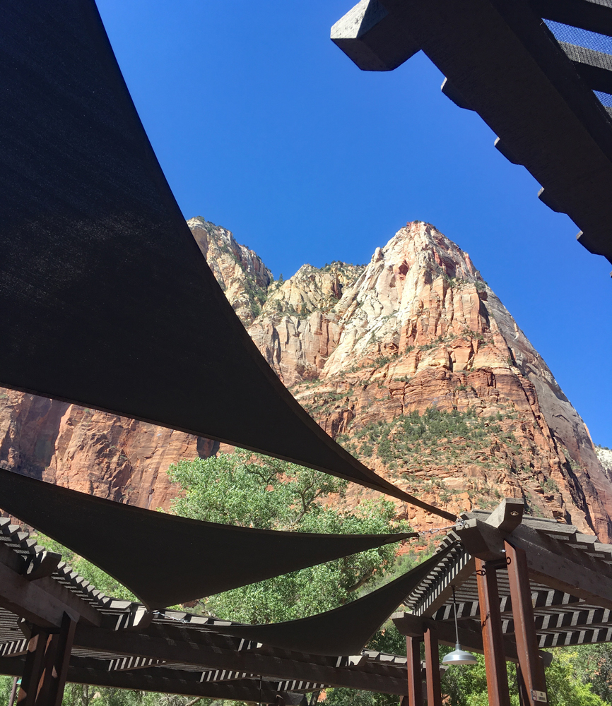
| Zion NP |
In 1997, Zion established a shuttle system to eliminate severe parking issues within the park during peak times of the year (during a few winter months private autos are allowed to drive the entire Canyon Scenic Drive but parking is limited). Additional parking is available in the nearby town of Springdale where free buses provide pickup and drop offs at nine locations (a boon to local businesses).

 |
| Zion NP |


 |
| Zion NP |


 |
| Zion NP |
 |
| young condor |
Over repeated visits to the park we hiked the lower and upper emerald trails, the grotto trail, the weeping rock trail, canyon overlook trail, and the riverside walking trail that lead to The Narrows trail head, the narrowest section of Zion Canyon. This is a gorge, with walls a thousand feet tall and where the river at times is only twenty to thirty feet wide. A hike through The Narrows required hiking in the Virgin River (there is no trail). Walking is moderately difficult, with knee deep crossings on the slippery and uneven river bottom with frequent pools up to waist deep. Close-toed shoes and a hiking stick are recommended (bring your own or rent them locally). It’s one of the most popular hikes in the park lasting an hour or all day (to do the ten-mile round trip). Given how chilly it was and how crowded it was, we opted to take a pass on The Narrows.


 |
| driving to and from Kolb Lake and condors |


 |
| Kolb Canyons road and Kolb Canyons Overlook |


 |
| driving to and Cedar Breaks NP |
We continued through the park on scenic highway 143 toward the ski resort area and small town of Brain Head (a much needed coffee break at Apple Annie's Country Store) plus an exploration of a campground dirt road that traced the Parowan Creek.


 |
| Parowan Gap |
 |
| Dixie Wagon pizza |
 |
| margaritas at Casa de Amigos |
Speaking of time, we found that we’d gotten ahead of ourselves. Scratching off the Canadian Rockies and the Olympic Peninsula left us with more time. Looking ahead at our stop at Joshua Tree NP, even if it meant veering a bit further west, we would still be left with more time than we’d planned on before arriving at Boyce Thompson by October 15. We’d have to give this more thought but for now we were off to try and get into Joshua Tree.
Our batting average for getting into Joshua Tree in the past was 0 for 3 tries. Either there was a fire in the park, a flood, or roads from the south entrance were closed due to landslides and/or construction. Earlier attempts to get in through the park’s Cottonwood Visitor Center southern entrance off I-10, while we were parked at one of our favorite California state parks, Anzo-Borrego Desert SP, had never worked. So this time, we tried a different tact by parking at an RV park in TwentyNine Palms, close to the park’s Oasis Visitor Center entrance on the park’s north side.
Getting to Twentynine Palms in one day wasn’t an option so we made an overnight stop at the Desert View RV Resort in Needles, CA. An interesting situation in Needles when we went to get diesel fuel. Fuel prices in Needles were around 4.45/gal. Just across the border in AZ? Diesel was 2.35/gal. Guess where we bought fuel?! Thank goodness for an iPhone app GasBuddy which lists/compares all the prices within a specific area. A free app that has saved us a lot of money in fuel prices over the years.


 |
| Amboy, CA |
The big draw the day we stopped to get coffee in the gas station (full of Roy memorabilia) was a bus full of German tourists all stopping to pose for selfies on the highway next to a “Route 66” logo painted on the road. As I recall, I don’t think that Tod and Buzz ever stopped their corvette in Amboy.
On the drive out of Amboy we passed the Amboy Crater National Landmark (BLM property). Prominently jutting up in the desert landscape, this relatively new (10,000 years ago) cinder cone had breached at one side sending out a considerable and extensive lava flow. Due to its relative ‘newness’, the cone lacked any mature soil and significant plant life. The base was littered with “blow sand”, windblown sediments more than three feet thick with wind-faceted pebbles of basalt.


 |
| murals in TwentyNine Palms, CA |


 |
| Joshua Tree NP |
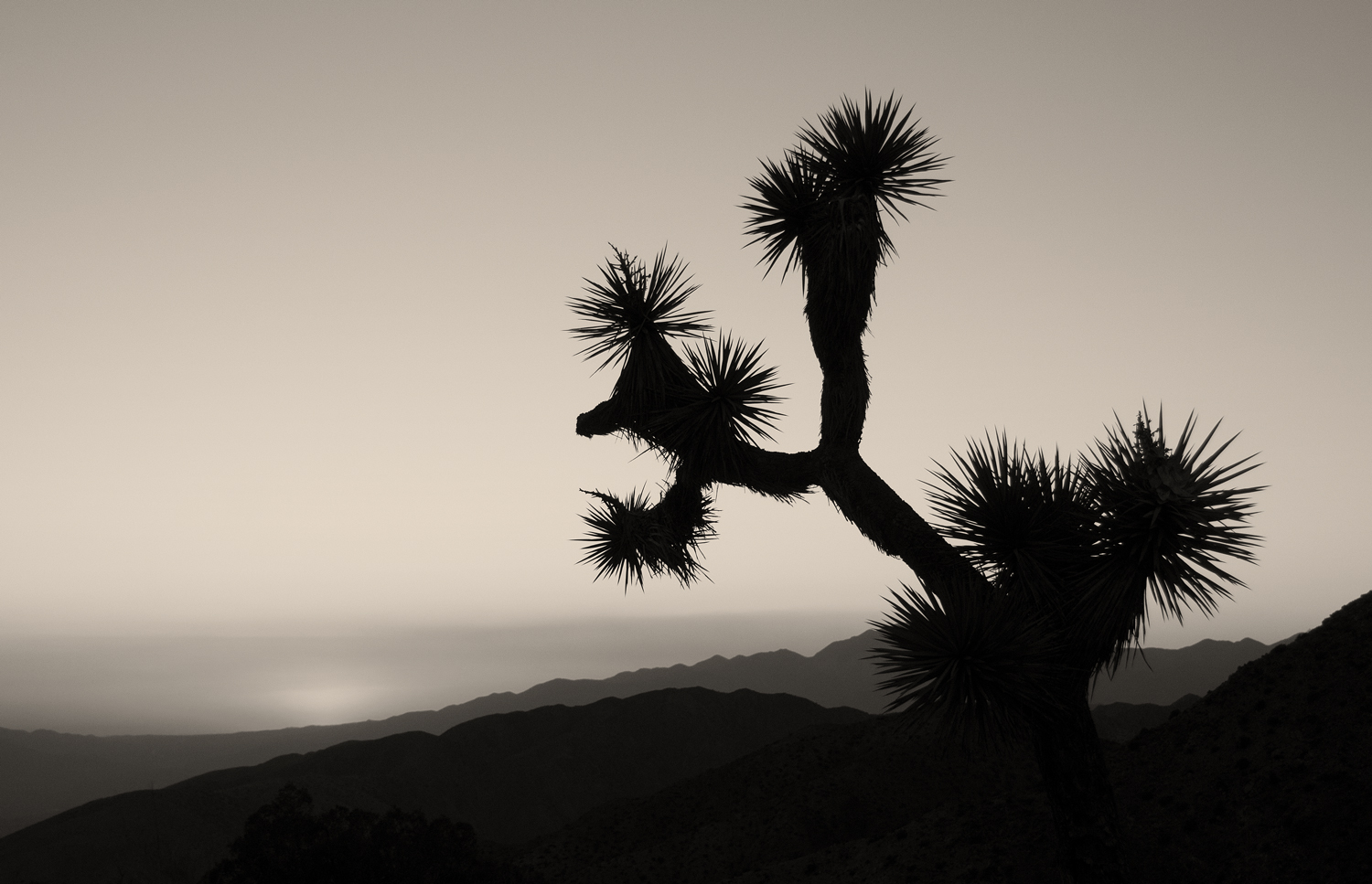
 |
| Joshua Tree NP |


 |
| Joshua Tree NP |

 |
| Joshua Tree NP |


 |
| Joshua Tree NP |

 |
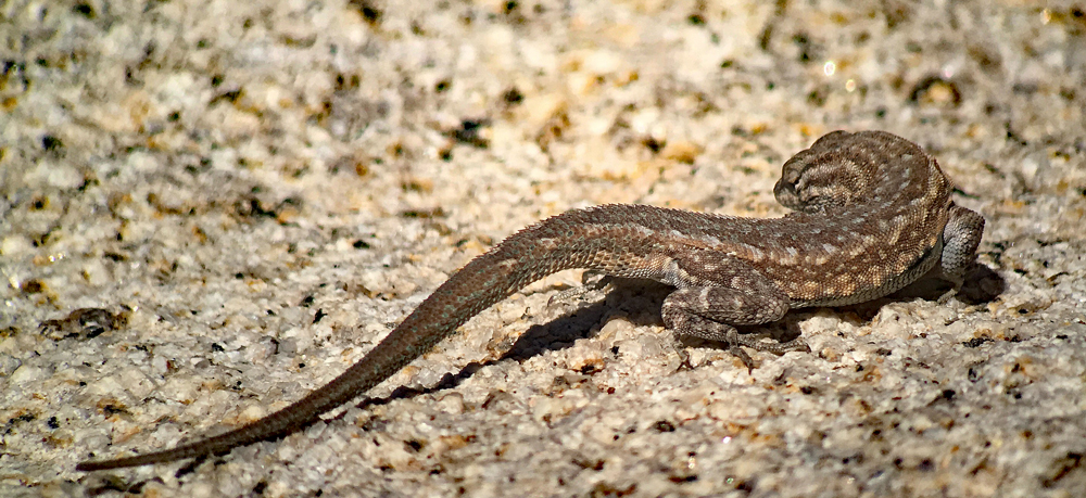
| Chuckwala |


 |
| Joshua Tree NP |
 |
| burrowing owl |
We decided to spend some time recouping in the Tucson area but again, it was too far to go all in one day. We overnighted in Yuma at the luxury RV resort, The Palms. And this was truly a luxury resort. Even though we were there for only a night, we’ve never filled out so many forms and waivers (it took more than five minutes) and were given a hefty packet of literature about the park enticing us to spend a winter (which we returned the next morning on our way out).
On our way to Tucson from Yuma on I-8, we looked forward to stopping at Dateland, a small dot on the map. While it’s now just a dot on the map, during WWII it was the site of two Army desert training camps used by General Patton’s troops, and, a hastily built airbase used for training B-25 bomber crews. Apparently the airfield wasn’t constructed well enough to stand up to the pounding of B-25’s coming and going and the entire B-25 operation was moved to Deming, NM. The existing buildings built for the air crews then became part of an Italian internment camp.
Just a few miles up the road in the 1940’s and 50’s, was Aqua Caliente, an exclusive resort used by many famous Hollywood stars. But the springs had long since dried up due to pressure from surrounding agriculture. Presently, the military still trains in the area (troops for Iraq and Afghanistan). But we were interested in what Dateland had to offer now: its Medjool dates and date shakes.

 |
| if your're stuck changing a flat, Dateland Travel Center is the place |


 |
| fun with Troy and Nancy at Saguaro Corners |


 |
| driving up to Mount Lemmon on Catalina Highway |


 |
| desert museum |


No comments:
Post a Comment