Wednesday, November 28, 2012

Red Rocks Rock

Headed to our next destination, Camp Verde, we had to backtrack on Hwy 89A. It turned out that it we were fortunate to have seen California Condors when we did. None were found while we were at the Grand Canyon nor were any present when we stopped again at Navajo Bridge.

driving into Sedona
Located in Central Arizona between Flagstaff to the north and Phoenix to the south, Camp Verde, in the Verde River Valley, was our next stop. We would be on the southwestern edge of the Colorado Plateau, adjacent to the Mogollon Rim, and deeper into the Upper Sonoran Desert region. But while Camp Verde was our target for the day, our real interest was in the nearby city of Sedona with its shopping and local cultural and scenic attractions.

site at Distant Drums
With a 200+ mile journey behind us, we settled into Distant Drums RV Resort, a convenient location for several area day-trips we had planned. To spend a week parked in the same site was a welcome change from our recent string of one day stands.

Carol shopped - Tom relaxed at Tlaquepaque
Our first day was spent recouping and regrouping with only a short visit to the the popular Tlaquepaque Arts and Crafts Village in downtown Sedona. A great place to spend a lot of money on Native American jewelry and pottery. No money spent but we greatly enjoyed looking. An otherwise slow day for us but that was about to change.

Page Springs/Bubbling Ponds
Buckeye
Cicada were out in force
Birding was again back on our agenda. Our first adventure included stops at several nearby biding hot spots. Among them were the Page Springs Audubon Sanctuary, both Upper and Lower Oak Creek IBA’s (Important Bird Areas), and the Page Springs National
Fish Hatchery. Added: Common Black Hawk, Anna’s Hummingbird, Acorn and Gila Woodpeckers, Bridled Titmouse, Phainopepla, Abert’s Towhee and Lazuli Bunting.

Red Rock State Park
Red Rock State Park
Following our morning at various IBA’s, we ventured over to nearby Red Rock State Park. Ecologically it offered both riparian and upland plant and animal communities along the perennial Oak Creek. As we hiked a couple of park trails we found cottonwood, sycamore, velvet ash, and alder in the riparian zone. Mesquite, hackberry and juniper with a variety of smaller bushes and what looked to be the vestiges of wildflowers from earlier in the season populated the upland zone. Before driving back to our RV we made a stop at the Red Rock Country - Coconino National Forest Visitors Interpretative Center to collect more information about local points of interest.
The next morning Inclement weather kept us pinned down. A convenient time to get caught up on laundry. Just over I-17 was the Cliff Castle Casino. We’re not casino going folks but they had on their menu a very inexpensive breakfast which we took advantage of as we were feeling particularly lazy. By mid-afternoon the weather had cleared enough for visits to Montezuma Castle National Monument and nearby Montezuma Well.

Montezuma Castle
Sycamores
The “Castle” dwellings, were constructed by the pre-Columbian Southern Sinagua peoples, who, for about 300 years, were agriculturalists with trade connections that spanned hundreds of miles. Early Sinagua lived in pit houses but later adapted to
Pueblo-like cliff dwellings. Several Hopi clans trace their ancestral roots back to the Sinaguas. The cliff dwelling ruins were a good deal smaller and not at all accessible as those we toured at Mesa Verde.

Montezuma Well - note cliff dwellins
restored irrigation ditch remnant
irrigation info
Montezuma Well, a unit of Montezuma Castle, was located about 11 miles away. Formed by the collapse of a limestone cavern, it provided a constant supply of fresh water. Sections of a man-made irrigation ditch dating back over 1,000 years could still be seen along a trail below the well. Today, the water is still relied upon for irrigating gardens and livestock in nearby Rimrock.

shrouded Mingus Mountain
leap of faith from hang glider launch - sail to the Cottonwood Airport
hang glider flight path map
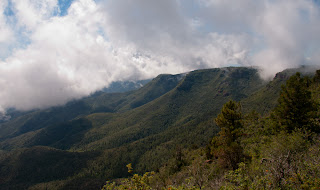
The next morning found us traveling another scenic section of Hwy 89A as we wound our way up to Mingus Mountain in the Prescott National Forest. We were occupied with stops at the Mingus Mountain Summit Picnic area, Mingus Lake and Campground, plus impressive panoramas of Cottonwood at the Hang Glider Launch. For a time we felt as though we were back in a cloud forest when a massive bank of clouds shrouded our location. A few more new birds while on Mingus: Band-tailed Pigeon, Painted Redstart, Canyon Towhee, and a migrant Hermit Warbler (which put us at 50 warbler species on the year!)


Jerome, Arizona - narrow and tight streets
sage advise
Haunted Hamburger special
The drive up Mingus Mountain had taken us directly through the historic one time roaring copper mining town of Jerome. Jerome, founded in 1876 is now a thriving tourist and artist community with a population of about 450. On our way back down the mountain we parked and explored various shops plus made a trek a up to the historic Jerome Grand Hotel. The hotel had started in 1926 as a hospital. It’s credited as one of the “most active haunted places” in Jerome after the hospital closed in 1950. In 1996 it was renovated into its current status as hotel.

Jerome Grand Hotel
a small sample of Jerome Ghost Pepper offerings
Hmmmmm....
In fact, the theme of ghosts and hauntings (after all, Jerome was a ghost town for a while) ran throughout. Aromas from the Jerome Palace Haunted Hamburger joint lured us to stop for lunch where we found the only “spirits” to be of the alcohol variety. Across the street was the Jerome Ghost Pepper which specialized in over eighty locally made hot sauces and salsas. After an intensive taste test, we settled on a jar of their mango chipotle salsa.

Tuzigoot ruins
On our way back to Camp Verde we included a late afternoon stop at the Tuzigoot National Monument, a desert hilltop dwelling ruins built by the Sinagua peoples. The day had heated up considerably so a hike to nearby Tavasci Marsh was put off to another time.

Flame Skimmer
Another day and another Hwy 89A road trip. First up was breakfast at the Wildflower Bread Company (another one of Robin Kinney’s valued where-to-eat tips). Even if you didn’t elect to eat, you could not possibly ignore the vast quantities of fresh baked breads and pastries. But we did eat and sated with food (at least for a while) we were off to Oak Creek Canyon, part of the Coconino National Forest. The 12-mile canyon road wound up a series of hairpin turns through a river gorge that had been described as the “smaller cousin” of the Grand Canyon. Having just seen the Grand Canyon, I’d say a much, much smaller cousin. A distant cousin at that. Oak Creek is reported to be the second most popular tourist destination in Arizona behind the Grand Canyon. Judging from the volume of traffic we had to agree.

is Harry Potter missing something?
Oak Creek, a tributary to the Verde River and one of only two perennial streams in the high desert, flowed through the canyon which had several popular pull-outs and trail heads to explore.  There were also a number of shopping opportunities. One shop stop definitely worth our while was Garland's Indian Jewelry which had an astonishing array of handcrafted Southwestern Native American arts and crafts. Hopi Kachina dolls, Pueblo pottery and hand-woven baskets, and Navajo rugs and jewelry. Again, lots of eye candy but no sales for us!

scenery along Oak Creek Canyon
view from summit looking back down the canyon
The summit was Oak Creek Canyon Vista offered several overlooks of the surrounding national forest and rock formations. And, more opportunities to shop at Native America vendors that were setup near the small interpretive center. But, we were more interested in watching a Hammond's Flycatcher we'd found at one of the overlooks. Had we continued driving further along on Hwy 89A we would have ended up in Flagstaff. Instead, we reversed course and headed back down the canyon back to Sedona.
But wait, there was more to the day. After a few failed attempts we finally honed in on the location of the Amitabha Stupa and Peace Park where we inspected a 36-foot stupa meant to inspire prayer, meditation, healing and peace. The site is also known as a local birding hot spot so as we sat and meditated we kept our binoculars near (nothing new appeared in spite of all the good karma).

Amitabha Stupa
Peace Park
On our way back to Camp Verde we detoured to the Sedona Airport Overlook for a wide, high mesa top scenic view of Sedona against a backdrop red rocks.

view from airport overlook
Finishing up the day we wound our way back down Hwy 179 out of Sedona with stops at Courthouse Butte and Chapel of the Holy Cross. The latter, built in 1956 is an architectural marvel. Designed by Marguerite Brunswig Staude, a pupil of Frank lloyd Wright, it belongs to the parish of St. John Vianny in Sedona and the Roman Catholic Diocese of Phoenix. Visitors of all faith are invited to attend a brief evening prayer service but from we understood, there are no regular Sunday services held at the chapel.

Chapel of the Holy Cross - Courthouse Butte in distance
Courthouse Butte
In addition to the chapel’s more traditional spirituality, starting in the 1960‘s and 1970‘s, Sedona began to attract large numbers of believers (“New Agers”) who came to explore the purported “power vortices” of the red-rock country. According to believers, a vortex is a site where the earth’s invisible lines of cosmic power intersect to form a powerful energy field. Sedona is full of people that offer services of past-life regressions, crystal healings, tarot readings, Reiki, channeling, and the like.
On our last full day in the area, we included a visit to Dead Horse Ranch State Park. We hiked a couple of park trails, one of which bordered the Verde River. The state park hosts the annual "Verde Birding and Nature Festival" (known as “Verde Birdy) held every April. As we were already close to Tavasci Marsh, we made a short detour to see it, but wound up looking from afar. It would have been a long a hike to get nearer and the day had already begun to heat up. Besides that's why we have binoculars, right? The rest of our day was spent prepping for our next move to more familiar territory in southeastern AZ.

Tavasci Marsh
Although we had spent a week here, we weren't fooled into thinking we’d seen it all. We had barely scratched the surface. There was Prescott to the west and further east, the Petrified Forest National Park. We doubted that this would be the last we'd see of Sedona. Wouldn’t it be nice, as it is has been with so many other places we’ve been, to experience Sedona again but during different seasons of the year?

Tom and Carol - Sedona 2012
Verde Birding Trail Map
cloud bound on Mingus Mountain
sign was for a black bear display but, hey...
Great Earless Lizard

1 comment:

  1. You got a lot in on your visit & on your post! Nice post on Sedona.

    ReplyDelete