

We left Page headed south on Hwy 89 through more of the scenic Navajo Nation. Coming from northern Arizona, it made more sense for us to visit the Grand Canyon’s North Rim. And because the North Rim is more out of the way, it would be less “touristy” (1/10th the number of visitors than the South Rim). And, gentle reader, you know how we prefer less visited stops.
Even after Labor Day Weekend, the Grand Canyon remained a very popular tourist destination. Following repeated failed attempts to make reservations at the North Rim's campground, we settled on the Kaibab CampeRVillage at Jacob Lake.
.jpg) |
| Navajo Bridge (left) |


 |
| California Condor "02" |
The condors sported large and easily identifiable wing tags. We set up our spotting scope so that folks without optics could enjoy closeup views. Many were non-birders but all seemed to be aware of the species critically endangered status. How exciting to be in such close proximity! At one point, the "02" condor flew from the new bridge and then landed on a bridge beam directly below where we stood, barely 12 feet away.
 |
| view of the new bridge |
 |
| Colorado River from the Navajo Bridge |
Noting wing tag numbers, one can easily find out more information about a particular condor by going to The Peregrine Fund detailed release information page, or by downloading a current condor population data table (PDF file) using the link found at the California Condor Restoration web page.
 |
| road to Lee's Ferry |
 |
| loading rafts at Lee's Ferry landing |
 |
| motorized rafting |
 |
| non-motorized |
Back on Hwy 89A and aimed toward Jacob Lake, we viewed the Vermillion Cliffs. They extended west from Page and are referred to as the second “step” in the Colorado Plateau. No doubt that the intensely red hue of the cliff was due to the heavy concentration of red iron oxide deposits.
 |
| view from Lee's Ferry landing |
 |
| Vermillion Clifs |
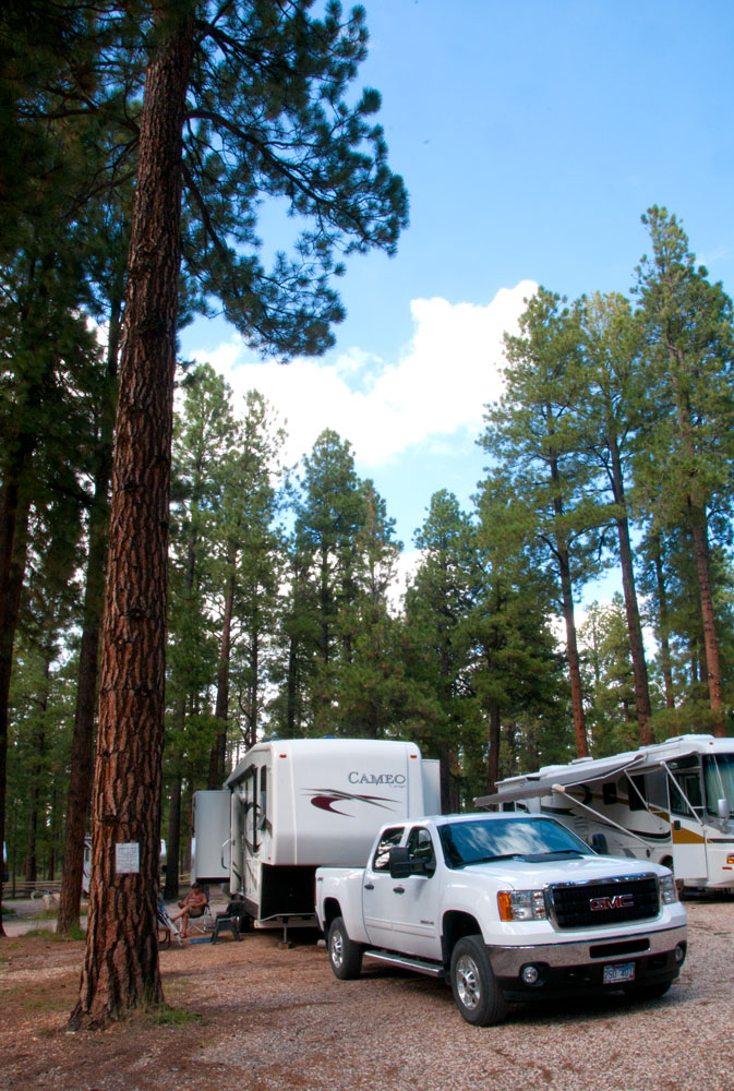 |
| site at Kaibab |
 |
| lodge dinning area |
 |
| Grand Canyon Lodge - North Rim |
 |
| finally - Carol got Tom to the Grand Canyon |
 |
| Bright Angel |
 |
| Bright Angel Point trail |
 |
| Cape Royal |
 |
| Point Imperial |
 |
| Roosevelt Point |
 |
| Wahalla Overlook |
 |
| thunderstorm Vista Cantada |
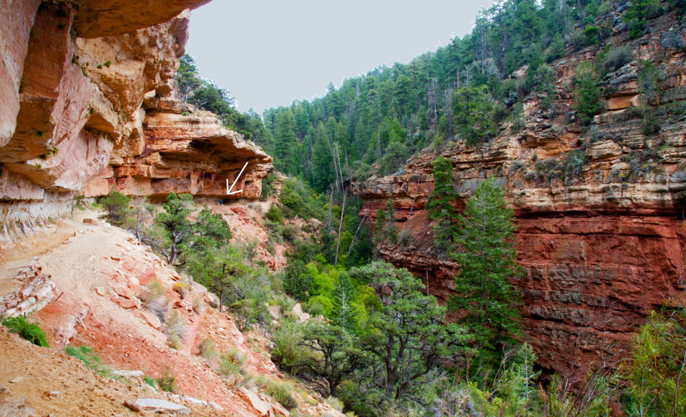 |
| Cliff Spring Trail - arrow is where Carol is standing |
 |
| view at Angel's Window |
 |
| Cape Royal thunderstorm |
You know Edward Abbey once said, “A man on foot, on horseback or on a bicycle will see more, feel more, enjoy more in one mile than the motorized tourists can in a hundred miles.” We couldn’t agree more.


I especially like the Wahalla Overlook shot. I was way excited to see my first ever Condor by the Navajo Bridge .. who knew there were folks trying to keep them from roosting close to the people!
ReplyDelete(BTW - figured out the commenting problem was a cookie thing!)